Coming to a Diversion Near You – Water Board’s 2017 Measuring, Reporting Requirements

Continuing our discussion from a previous post, http://allwaterrights.com/2016/01/27/diverters-must-report-weekly-daily-or-hourly-starting-2017/, surface water diverters must have some kind of measurement system, and must report diversions more frequently.  The Water Board posted a fact sheet online that summarizes the emergency regulations:  SENATE BILL 88 AND EMERGENCY REGULATION FORMEASURING AND REPORTING ON THE DIVERSION OF WATER

Many diverters, particularly those who report less than 100 acre-feet (AF) per year, can find enough information in this blog to successfully install their own measurement devices.  100 AF per year is equivalent to a year-round, 24-7 diversion of 0.140 cubic feet per second (cfs).  If the diverter only uses water during the irrigation season, the equivalent rate is higher.  For example, a diversion for 90 days is only 1/4 of a year, so the rate is proportionately 4 times greater:  0.560 cfs.

What are some of the other regulations?  Here are a few from the January 8 version, which still has the edits shown.  The first is that diverters must “immediately” report changes in name, address, or ownership.  Sometimes, buyers of property don’t even know they have a permit or license!  Not immediately reporting something a buyer is not even aware of, puts the new owner in legal trouble:20160108_prop_regs_S_915-916

There are changes in the regs which we have already discussed, in measurement devices, reporting frequency, and who is legally qualified to install measurement devices:

20160108_prop_regs_S_933_meas_dev_Part_2_of_4

20160108_prop_regs_S_933_meas_dev_Part_3_of_4

20160108_prop_regs_S_933_meas_dev_Part_4_of_4


20160108_prop_regs_qualified_indiv

More on the regulations later, including additional information about how to comply with the law, stay out of trouble, and protect your right to divert water

Summary of Water Rights, Flow Measurement Posts So Far

There have been 25 posts so far, on the types of California surface water rights, flow measurement devices, and how to measure diverted flows.  You’ll see new posts once or twice a week.  Please send suggestions for post topics!  We have discussed:

  1. All Water Rights, California
  2. Read Me My Rights (How do you know if you have a water right?)
  3. Reasonable And Beneficial Use Depends On Who You Are
  4. The Smartest Water Expert In California (Chuck Rich)
  5. Riparian Rules by Chuck Rich
  6. Water Rights – Why Do They Exist? Which Kinds Are There?
  7. Water Rights And Engineers
  8. California Water Right Holders Now Required To Have Measuring Device
  9. What Is Your Place Of Use?  (Where can you legally use your right?)
  10. Places Of Use – Adjudicated (Decreed) In The State Superior Court
  11. A Place For Permits And Licenses (Places of Use)
  12. Nothing Secret About It  (This is all public information.)
  13. Quick Change of Subjects: What’s a Water Right Permit Cost?
  14. Life Of Reilly: If You Can’t Measure It, You Can’t Manage It!
  15. How to Divide Up a Decreed Water Right – Part 1
  16. How to Divide Up a Decreed Water Right – Part 2
  17. Weirs – Planning, Building, Measuring Flows
  18. From weir to orifice in only an hour
  19. Chilean Water Rights at (darn near) the Driest Place on Earth
  20. Some Hope in Rain and Snow Totals
  21. Is John Stealing Water?? Orifices – Right Size and How to Measure
  22. Worried about SB 88? That’s what this blog is for! Get a device in, send a photo to the Board, record and report your diversions
  23. Flumes – installing for decades of flow measurement, Part 1
  24. Simple Weirs and Orifices, on video, and in photos!
  25. Diverters must report weekly, daily, or HOURLY starting 2017!

Diverters must report weekly, daily, or HOURLY starting 2017!

SWRCB_Header

So on Tuesday, January 20, “The State Water Resources Control Board (State Water Board) adopted regulations Tuesday evening requiring all surface water right holders and claimants to report their diversions. Those who divert more than 10 acre-feet of water per year must also measure their diversions.”  Click the logo above to see the 2-page document on the Board’s website.

Well, how bad can it be?  Before January 20, most diverters had to report monthly diversions, so 12 volumes per year, plus the annual total.  That’s 13 numbers.  The required frequency a year from now will be increased quite a bit, to weekly, or daily, or hourly:

For instance, large diverters with a claimed right to take 1,000 acre feet of water or more per year are required to have a measuring device or measuring method capable of recording at least hourly in place by Jan. 1, 2017; those with claimed rights to divert 100 acre feet or more must comply by July 1, 2017 and record at least daily; and those with claimed rights to divert more than 10 acre feet must comply by Jan. 1, 2018 and record at least weekly.

How can flows even be reported hourly?  See the end of this post.  What if someone decides to skip reporting, and let the Board catch up with them later?  The FINES can be large enough to hurt – we’ll discuss this in a later post.

At the minimum reporting requirement of weekly, the volume is 10 acre feet (AF) to 100 AF.  What is 10 AF in terms of a seasonal agricultural diversion?  All the flows shown below are year-round; if the diversion only runs seasonally, the actual water right might be 2 to 10 times the calculated amount, depending on how long the season is and when the stream dries up.

10 AF  =  0.014 cubic feet per second (cfs) year-round, or 6.2 gallons per minute (gpm).  That’s a domestic right, enough for a family house, garden, and perhaps 15 trees or a yard.

100 AF = 0.140 cfs, or 62 gpm year-round.  Depending on soil, this is enough for 3 to 15 acres of pasture or hay, maybe 15 cows or steers, or maybe 30 acres of a mature walnut orchard with micro-sprinklers.  This is enough for a little extra money, still not enough to support a family.About_1.4_cfs_over_weir_edited_2_small

1,000 AF = 1.40 cfs or 620 gpm year-round.  This is enough for 30 to 150 acres of pasture or hay, or maybe 300 acres of orchard.  Water in this quantity could support a family and would be considered a ranch or farm.  The 4′ weir above has about 1.4 cfs going over it.  As mentioned above, if this diversion only runs 6 months of the year, and really only gets the full flow for 3 months, then the actual continuous water right might be 5 cfs.  It might be easier to reverse the thinking: a 5 cfs right might run at 5 cfs for 3 months,  3 cfs for a month, 2 cfs for 2 months, and be off the rest of the year.  That’s closer to a 2 cfs right year-round, or about 1,400 AF per year.

How is flow measured HOURLY?  The only practical ways to do this used to be an old mechanical recorder, like a Stevens F Recorder (pen on paper on rotating drum) you can still see on some creeks.

More likely today, it will require a battery-powered pressure transducer set inside a 2″ pipe bolted on the side of the weir, or headwall, or other permanent structure.  These cost from $400 to $1,200 or more, depending on the brand and more importantly, quality.  The higher the quality, the less they have to be checked, and have dirt removed from the bottom sensor.  The maintenance can be significant – in warm water with algae, the sensor might have to be cleaned once a week.  If it’s not maintained…well, then at some point it stops recording that data that the Board requires.

WaterLevelLogger_wl300_1

Here’s one that would do the job, from http://www.globalw.com/ products/levelsensor.html.  It sits there and records water levels night and day, for months at a time before it has to be downloaded to a computer.  The data file that is downloaded is what is actually sent to the Board – a spreadsheet of flows for 6 months would be half an inch think and unusable!

That’s enough for now, a good night to you all.

Simple Weirs and Orifices, on video, and in photos!

Simple to set up weirs and orifices!

On YouTube:  https://youtu.be/H2tOEV-zitk

01a_EW_1922_01This is a corner of a diversion box built by my wife’s grandfather, Emil Wigno, in 1922.  The fleur de lis he brought with him from France.  🙂   Emil planted hay, peaches, prunes, and finally walnuts.


01_At_Diversion


Hi, I’m Shawn Pike.  🙂

Now 2″ x 6″ boards, cut 1/2″ to 1″ shorter than the width of the board slots, are stacked up in the diversion box.

02_One_Board_In


03_Weir_Board_Going_In


The weir board is cut 3-1/2″ deep.  There are 2 weirs, one 1.0′ wide, and the other 0.5′ wide.  These are contracted weirs, since water on the edge has to turn to go through.04_1_Ft_Weir


The small weir is blocked off, so the 1.0′ weir is left.  This is a 1.0′ contracted weir, and the flow can be read right out of the correct table in the Water Measurement Manual.

06_1_Ft_Orifice

07_0.5_Ft_Orifice


By simply flipping the weir board upside down, we have an orifice!  If the downstream water is higher than the hole, then the orifice is “submerged”.  If the flow out the orifice is free-flowing, then a different equation is used.  Either way, calculating the flow is pretty easy because we know the orifice area, and depths of water upstream and downstream.

Here’s the pretty photographer and videographer, in the gold-mining town of Bodie.  🙂Wiggy_At_Bodie

Flumes – installing for decades of flow measurement, Part 1

What is a flume?  Most people think of long flumes that carry water across a canyon, or along the edge of a mountAlong_Aqueductain, to get water through steep country.  These flumes are expensive and time-consuming to build so they have to make economic sense.  In early
California, flumes were used to get water from a stream to gold-bearing gravels Pipe_Flume_From_Endwhere there wasn’t water.  Gold was certainly worth the expense!  It takes water to wash gravel over a washboard so gold can settle out in the ribs or slats.  Flumes were then used to transport cut logs from the mountains down to mills in the valleys.  Lumber also brought in enough revenue to make flumes worth it.


The kind of flume for measuring flows is a concrete, metal, fiberglass, or wood structure built to exact dimensions.  The newly-built flume shown below is formed concrete.  It took 4 days for a crew of 5 people to make this.  This flume is 3.0′ wide, and will be used toFlume_newly_installed_edited measure diversions of up to about 16 cfs.  This device could last for 40 years before it becomes too worn to be accurate, or develops cracks that let parts of it settle.

Parshall_Flume_DimensionsFlumes are much more expensive than a weir box with boards.  It costs 3 or 4 times as much to install.  On the plus side, there are no boards to change, it measures a wide range of flows with good accuracy (+/- 5% in the first 10-15 years of its life), and it will pass debris and gravel through without clogging.

The photo below is of a flume that has been installed for 30 years.  It shows what can become a common problem: the ditch below has not been kept as deep as it should be, so the flume is “flooded out”.  The flow computed by using the staff gage depth is about 40% more than actually goes through the flume…so the ranchers who use theOld_Parshall_2 water could be shorting themselves.

Rehabilitating a flume is not impossible, but it is not often done.  The whole floor could be raised by pouring a higher concrete floor, making sure it slopes exactly the way the old floor sloped.  Usually a new measurement device is installed nearby, and the old flume is not used anymore.

More on the details and how-to’s of flumes later.  For now, we sure appreciate the snow and rain!

Is John Stealing Water?? Orifices – Right Size and How to Measure

Is John Stealing Water??  John Casey has a cattle ranch near Adin, where he grows pasture and hay to raise about 70 Angus steers.  His place is 240 acres with lower irrigated land and forest on the higher part.  He has an adjudicated water right of 2.00 cubic feet per second (cfs) from Preacher Creek, to irrigate 80 acres.

John’s downstream neighbors claim he steals water.  He says he can show that he takes only 2 cfs, or less when the flow drops down in the summer.  Can he prove it?John_Headgate_edit

As we can see, he has a square headgate at the head of his ditch.  It is 2.0′ wide, and can open up to 1.5′ high.  Right now, John says he is diverting 1.05 cfs.  His evidence is that his gate is open 0.15′, the water is 0.57′ deep on the upstream side, and the water is 0.20′ deep on the downstream side.  Is that enough to check what he says?

The box in which the gate sits has smooth walls, and the gate closes flush with the bottom when John is not diverting.  The water continues in a straight path from upstream to downstream.  That means the weir has “suppressed” sides.

This is in contrast with, for example, a hole cut in the middle of a 2″ x 12″ weir board.  The water on the sides has to make the turn to go straight through, so the hole in the board is an example of a “contracted” orifice.

Let’s look at the tables for orifices in the back of the Water Measurement Manual.  Table A9-3 is for submerged, suppressed weirs.WMM_Table_A9-3_suppressed

We can’t see the downstream side of the weir, but the water is above the bottom of the edge of the gate, so it is submerged rather than free-flowing.

This table has flows calculated for a minimum area of 2.0 square feet (sq. ft.).  However, the area of the opening at John’s headgate is 2.0′ wide x 0.15′ high, or 0.30 sq. ft.  Fortunately, the equation, Q=0.70A(2g Δh)^0.5, is listed right at the top of the table.  We can calculate the flow using that.  Q is the flow in cfs, A is the area of the orifice hole, g = the acceleration due to gravity, or 32.2 ft/second^2 (feet per second squared), and Δh is the difference between the upstream and downstream water depth.

So the flow Q = 0.70 x (2.0′ x 0.30′) x (2 x 32.2 x 0.37′)^0.5 = 1.03 cfs.  So far so good – John is taking 52%, or just over half of his right when 100 percent of flows are available.  But, how much flow is actually available right now?

Let’s use the “sum of the boxes” method.  Instead of measuring the amount of water in Preacher Creek at the top, before any diversions, and then estimating how much flow is being lost to evaporation, transpiration, and infiltration, and then estimating how much flow is subsurface above John Casey’s ranch and “pops up” out of the ground below, we’ll look at what each diversion amount is, plus the amount still in the creek after the last diversion.  This is very useful because none of the instream losses have to be estimated – we just add the diversions and flow still in the creek, and that amount IS the available supply.  Some Superior Court judges in past decades were pretty smart and actually ordered that available flows be calculated this way.

Susan_1_of_2_DecreeParaAvailWaterEqualsDiversionsSusan_2_of_2_DecreeParaAvailWaterEqualsDiversionsThe paragraph above, from the Susan River Decree, defines available water supply as what is being diverted, plus the flow passing the last diversion.

There are 4 diversions on Preacher Creek, and here are the amounts being diverted:

  • Diversion 1 (John Casey) 1.03 cfs  of a 1.60 cfs water right, 52% of his total right
  • Diversion 2 (Amy Hoss) 1.67 cfs  of a 3.80 cfs water right, 44% of her total right
  • Diversion 3 (Mark and Cindy Sample) 0.55 cfs  of a 0.88 cfs water right, 62% of their total right
  • Diversion 4 (Quint and Marcie Minks) 1.32 cfs  of a 2.50 cfs water right, 53% of his total right
  • Flow still in the creek past the Minks Diverison – Quint estimates about 0.7 cfs

The total diversion-plus-bypass flow is about 5.3 cfs.  The total rights on the creek are 9.48 cfs.  Therefore, the total available flow = 5.3 / 9.48 = 56%.

So, John is right, he is not stealing water!  He is taking 52% of his water right, when he could be taking 56% according to the “sum of the boxes” method.  Not only that, but Amy could take more, the Samples should reduce their diversion, and the Minks’s could take a tad more.  Well, that’s theoretical – Quint and Marcie Minks probably cannot seal up their dam completely, so there may be a little bit less flow actually available for diversion.

From weir to orifice in only an hour

Orifice devices are needed for flat ditches, where the fall may be as little as 0.20′ (2.4″) from upstream to downstream.  An orifice is simply a hole through which water flows, so it can be accurately measured.  The photo below shows a submerged weir, flowing from right to left.  The water in the ditch downstream (left) is above the hole in the boards.Orifice_Side_Top_2 You already noticed the amazing thing about this orifice, didn’t you?  I could tell you are savvy that way.  Yes, this is the same Briggs Manufacturing weir box as the ones in the previous post!  It has the same 2″ lumber in the upstream board slot.  Now the flow goes through a precisely cut hole in the boards, with a known area, instead of over the top of the boards.

Staff_GageInstallation is just like with the weir boxes installed in the previous post, too.  For convenience, staff gages may be attached to one side of the box so it is quick to read the water depths.  So the precast concrete box is versatile, it can be used as both a weir and an orifice.  Actually, some ditches need both a weir and an orifice.  This is especially true in a ditch where a gate or boards may be put in the ditch below the weir box, to flood hay or pasture just below the measurement device.  All it takes is a change of a couple of boards.

WMM_Cover_small


The big difference in measuring the flow is that, instead of “sticking” the weir boards, now the depth of the water must be measured upstream and downstream to use a weir equation or table.  The “difference in head”, or water surface elevation, gives us a value needed to read the table or use an equation to figure out the flow.  What tables or equations?  These are out of the water measurement bible, the Water Measurement Manual.  We will discuss these very soon in following posts.

This was a quick post to show how you can get 2 uses out of one device, to make your life simpler.  That’s all for now, hope you had a Merry Christmas!


Weirs – Planning, Building, And Measuring Flows

Tomorrow is Christmas 2015!  Merry Christmas all.

Weirs are the least expensive permanent measurement device you can install.  Materials will cost the diverter in the range of $300 to $2,000; hiring the backhoe to set it in place probably costs more than the materials, unless the diverter already has a backhoe or crane.

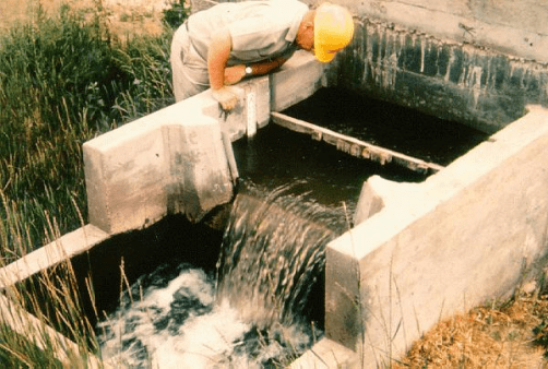
The weir below was precast by Briggs Manufacturing in Willows.  The weir is a cast concrete, 3-sided box with board slots for 2″ lumber.  It’s pretty simple, and relatively easy to install.  This particular weirWeir_Showing_Board_Slotsneeded metal wing-walls to keep the dirt on the sides from washing out.  Note that there are two board slots on each side, one for the boards to slide in, and the other to help make sure a nappe or air gap is created as water flows over the boards.

Step one is determining if there is enough fall in head from upstream to downstream.  A weir needs 0.7 feet (0.7′), or 8.4 inches (8.4″) of fall to be sure it will work correctly.  The 0.7′ figure is because the pool of water needs to be a maximum of 0.45′ above the top of the weir boards on the  upstream side.  Then, the water in the ditch downstream of the weir needs to be at least 0.25′ below the top of the boards so the water flows freely, separating from the boards and having an air gap on the downstream side.  0.45′ + 0.25′ = 0.70′.Sticking_Weir_sharpened

The photo above shows a ruler in tenths of a foot, held vertically on top of the weir boards.  This is called “sticking the weir”.  When the ruler is turned face-on to the flow, the water will climb up to the same level as the flat pool upstream of the boards.  It’s physics – standing water has an energy level equal to the height of the water surface.  Moving water has both potential and kinetic energy, so the energy level or line is above the surface of the

Sticking_Weir_zoom_sharpenedwater.  Moving water stalls behind the face of the ruler, giving the height of the water if it were standing still.  That is the water depth that has to be measured for weirs.  The photo is showing a water level of 0.31′ – it wobbles up and down just a little – so we know this weir is flowing at about 0.6 cfs per foot of width.

If the ditch is very flat and shows no ripples when flowing, it’s probably too flat, and an orifice or a flume will be needed instead of a weir.  Future posts will discuss those measurement devices, and others too.

Step 2 is figuring out how big a box is needed.  Fortunately, there is an easy rule.  1.0′ feet of width is needed for every cubic foot per second (cfs) that will be diverted.  For example, if the diversion will be a maximum of 3 cfs, then the diverter will need a 3′ wide weir.contracted_weir  If in doubt, get the next larger size since the cost is not much more.  The reason for this rule is that a weir can be accurate to plus or minus 5%, well within the accuracy needed for diversions in the field.  If the pool upstream of the weir boards is more than 0.45′ over the top of the boards (or less than about 0.1′ over the top of the boards), the accuracy of the weir is worse than the standard.

Measurement devices need to be planned and operated correctly to assure the diverter (and ditch-tender, and neighbors, and the State Water Resources Control Board, andsuppressed_weirpossibly 10 other state and federal agencies, and possibly even the Superior Court in the very worst case) that the flow measurement is correct.  It’s like a truck speedometer – they can get less accurate over time.  It’s no problem if they read faster than the driver is actually driving, but if they read slower, the driver is in danger of unknowingly speeding and getting a ticket.  Ouch.

The actual installation process is fairly simple to describe.  Get 1 to 4 yards of 3/4″ minus road base rock delivered on site, trucked from the gravel plant.  To save a lot of hassle, skip the forming up and pouring a concrete weir, and just call Briggs Manufacturing and order a weir to be delivered on site.  Dig a shallow, level (flat), square hole in the bottom of the ditch, about 8″ deep, and 1′ longer and wider than the bottom of the weir.  Shovel base rock into the hole about 2″ deep, and compact it.  Rent a gas-powered thumper, or use the bucket of the backhoe.  Pour another 2″ and compact it.  Use a level and make sure the top of the base rock is level side to side, and along the ditch.  Since it packed down during compacting, add the last 1″ and compact it, so the top of the road base is about 4″ below the bottom of the ditch upstream and downstream.

The installer needs to make sure to have a piece of 1″ steel bar that is about 1′ longer than the the width of the weir box.  There is one hole through the top of each side of the weir – stick the rod through that and hook onto it with a chain to lift the weir.  Set it in place, and make sure it is sitting level.  The installer might have to gently press down on one side with the backhoe to get it completely level.  Now the floor of the weir will be at the level of the bottom of the ditch.  Remove the steel bar, and fill the weir box inside about 2′ deep with some dirt.

Next, install the wing-walls, if needed.  These will keep the material on the outsides of the weir from washing out in a steeper ditch.  Then backfill with the remaining road base on the sides, compacting it for each 6″ of depth.  If tNew_Weirhe native soil holds water well, it could be used instead of base rock to backfill, saving a little bit of money.  Remember the dirt that was placed 2′ deep inside the weir?  This will keep the weir weighted down so it does not move during backfilling.  Also, it will keep the sides from being slightly bent in by the pressure of compacting the backfill.  The reinforced concrete weir boxes are strong but the walls can be bent in with enough force.

That’s it!  The weir box is installed and ready to go.  New weir boards, usually 2″ x 6″ or 2″ x 8″, should be cut about 1″ shorter than the width inside the board slots.  For example, a 3′-wide weir will have board slots about 2″ deep.  The full width from inside of board slot, to inside of the opposite board slot, is 3′-4″.  The boards should be cut about 3′-3″ long.  That way, when they swell a little bit, they won’t get impossibly stuck.

Happy measuring!  Good night to all, Merry Christmas, and blessings in the New Year.

Life Of Reilly: If You Can’t Measure It, You Can’t Manage It!

A friend of mine, Chris Reilly, summarizes everything you need to know about measuring flows into your surface water diversion:  “If you can’t measure it, you can’t manage it!”  Except for riparian rights and some very small water rights, diverted flows have to be measured.  Why?

Full_DitchFlooded_Field

Dry_DitchLegally, to ensure your neighbors, the Board, and/or a Superior Court Judge that you are diverting no more than your water right.  Practically, how do you know if you are getting as much water as you should?  As surface flows decrease through the summer, every bit less means some pasture, hay, orchards, row crops, or something else does not get irrigated.

If you have nWMM_Cover_smallever measured flow into a ditch before, well, here goes, I am going to leak the secrets right here, I’m going to violate the Unspeakable Code Of The Water Measuring Brotherhood, the ve
ry deepest, most powerful wisdom of how to measure your flow will appear on this very page.  After this, who knows if you will ever hear from me again, once this classified information is made public?  Well, not really, but few people have heard of the Bible Of Water Measurement, the
 USBR Water Measurement Manual (WMM)

Let’s look at 3 common measurement devices detailed in the manual:  weirs, orifices, and flumes.  Properly installed and maintained, these devices can measure flow within plus or minus 5% of the actual amount.  The photos below are from the WMM, which has lots of diagrams that make it easy to see the details of how each device works.  First, the weir:

WMM_weir

You have seen these before, they’re just a level plate or board of a specific width, with a relatively still pool behind them.  That’s it!  By measuring the height of the pool above the edge of the plate or board, you can use tables or equations from the WMM to determine what the flow is.

WMM_orifice

Above is shown an orifice.  Not much to see, is there?  In this case, it is just a hole, lower than the upstream flow.  That is physically all an orifice is.  Knowing the size of the hole, and how high the water is over the center of the hole, and how high the water is down the ditch, a table or equation can be used to figure out the flow.  The gentleman above is using a square gate with a certain width.  The area changes with how high the bottom of the gate is, not hard to figure out.

WMM_Flume_01

The photo above shows a Parshall Flume.  These are great for measuring high flows without needing a lot of “head” or the drop in the water from upstream to downstream.  By knowing the depth at a certain point, a table or equation can give the flow amount.

We’ll go into how to use tables for specific measurement devices in later posts.  It’s enough for now to know that if you have a decent measurement device, then you CAN manage your flow, as well as proving that you are taking no more than your legal water right.

Quick Change of Subjects: What’s a Water Right Permit Cost?

What does it cost to get a surface water right?  If your land is not riparian to the stream where the water is, or maybe one parcel is but your other 5 parcels are not, then you’ll need to file for a (Post-1914) appropriative right with the State Water Resources Control Board.

AlmondOrchard

Let’s say you want to irrigate 50 acres of new almond orchard in the Sacramento Valley.  How much water do you need for micros-sprinkler irrigation?  Let’s use the value for a 5-year-old orchard, about 3.33 acre-feet (AF) per year for irrigation and frost protection.  That number comes from the U.C. Davis Report Sample Costs To Establish An Orchard And Produce Almonds Sacramento Valley – 2012, at http://aic.ucdavis.edu/almonds/cost%20studies/AlmondSprinkleSV2012.pdf ,

The total annual volume of water for 50 acres is 3.33 * 50 = about 167 AF/year.  That equates to a constant flow of 0.03 cfs.  But, you probably irrigate one day per week, so 7 times the average rate = 0.21 cfs. So, in your permit application, you would need to apply for 167 AF/year, diverted at a maximum rate of 0.21 cfs.

To get the rate for filing for a permit with the Board, we need to check the fee schedule:   http://www.waterboards.ca.gov/waterrights/water_issues/programs/fees/docs/fy15_16_fnl_fee_schd_sum.pdf

SWRCB_fee_summary_permit_app

So your application fee would be $1,000, plus $15 per AF over the first 10 AF.  Your cost would be $1,000 + (167 AF – 10 AF) * $15/AF, for a total of $3,350.  There is also an annual cost:

SWRCB_fee_summary_permit_annual

Your annual fee would be $150 + $0.063 per AF over the first 10 AF.  Your annual cost would be $150 + (167 AF – 10 AF) * $0.063/AF, for a total of $160/year.

Of course, these costs are if it’s a “slam dunk” and there are no complications.  There would likely be a 1602 permit required by the California Department of Fish and Wildlife, and there could be other permits.  If anyone contests the application, then you would have more fees (see the schedule), perhaps attorney fees, and perhaps a negotiation to use water from someone else’s diversion.